
| Coordinates: | 56°54'03,99'' N
24°07'03,40'' E
Google Maps (localisation not exact, possible mistake up to 200 metres) |
| No: | 197 (list of all monuments) |
| Category: | Palaces and manor houses |
| Address: | Riga, Ziepniekkalns, in the gardening lots south from Misas Street |
| Year of construction: | ? |
| Condition: | Does not exist |
| Value: | Architecture |
This manor house has not been preserved.
Images
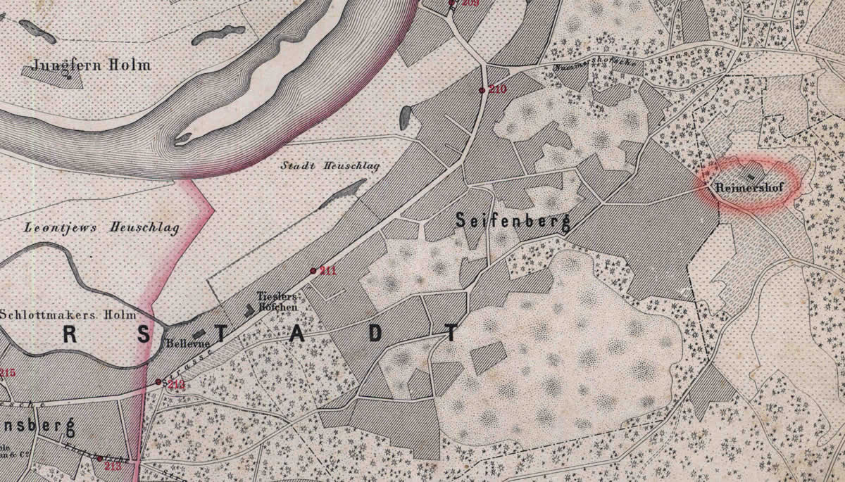
Reimer manor in the map. 1876
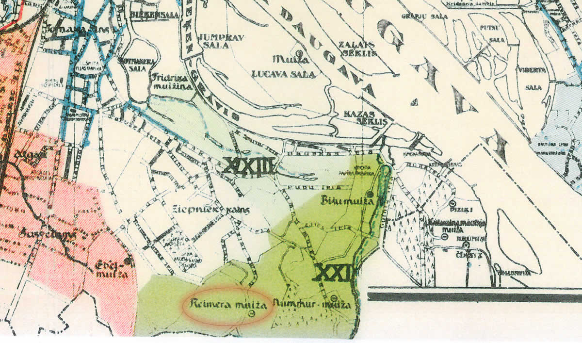
Reimer manor in the map. 1930
References
- Rīgas pilsētas administratīvo robežu karte, 1930
- Rīgas plāns, 1:50 000, kanalizācijas un novadgrāvju tīkls, 1930.g.
- Plan der Gouvernements Stadt Riga nebst Umgebung, R.Stegman, 1876