
| Coordinates: | 57°00'09,10'' N
24°05'12,84'' E
Google Maps (localisation not exact, possible mistake up to 60 metres) |
| No: | 169 (list of all monuments) |
| Category: | Palaces and manor houses |
| Address: | Riga, Voleri, in Kremeri, NE from Kremeri nature reserve |
| Versions of name: | Kremera muiza, Krämershof, Kremers Hof |
| Year of construction: | 16th - 17th c. |
| Condition: | Does not exist |
| Value: | Architecture |
This manor has been shown in a map drawn by J.C.Brotze after the map of E.Tolk from 1700 as well as in a drawing from 1701 where is shown landing of the troops of Charles XII at Kremeri manor.
Images
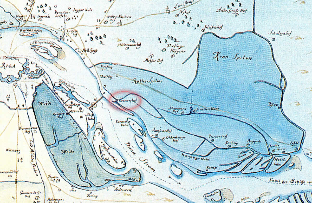
Kremeri manor, fragmetn of the map by E.Tolk. 1701
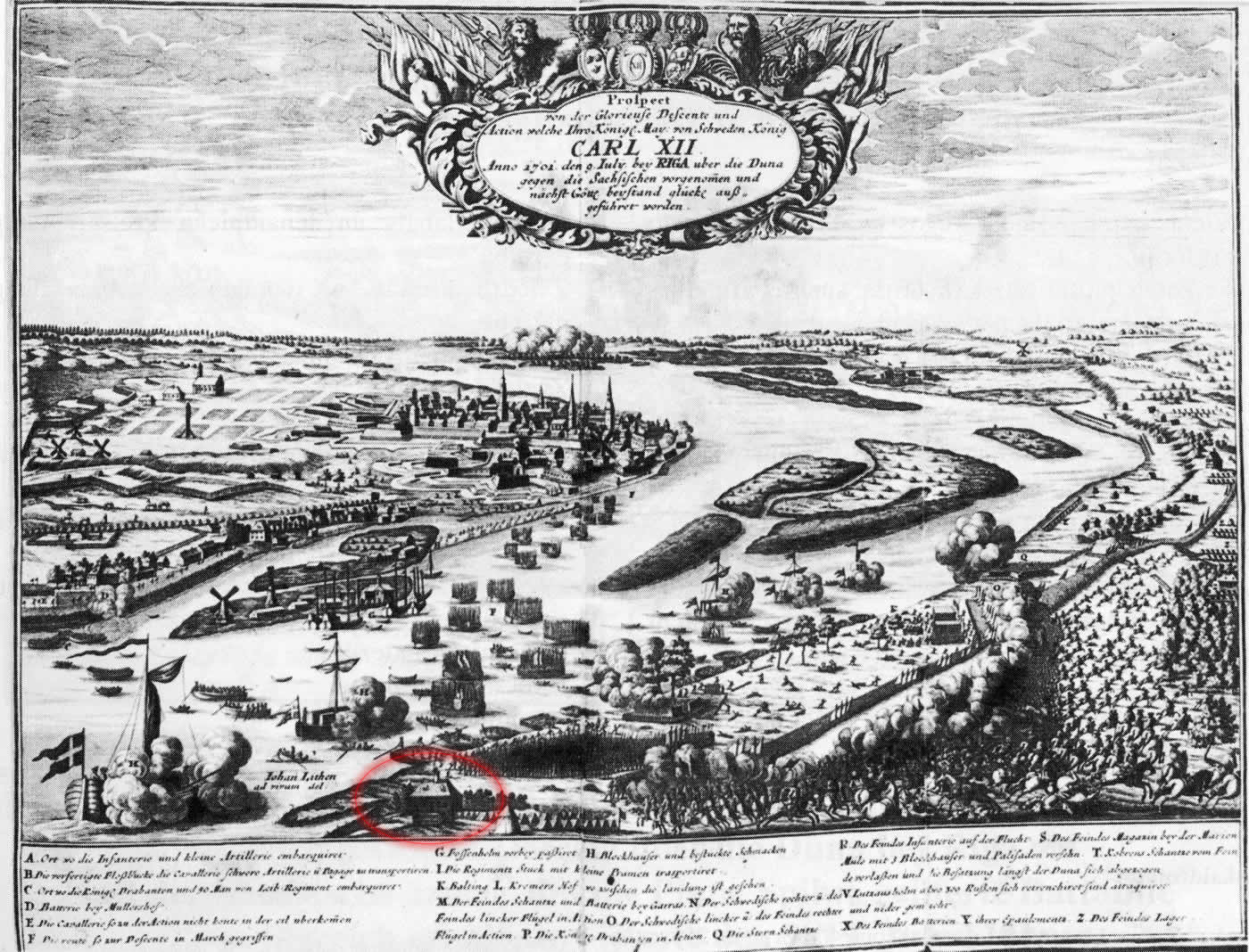
Kremeri manor, landing of Charles XII. Engraving by J.Litten. 1701
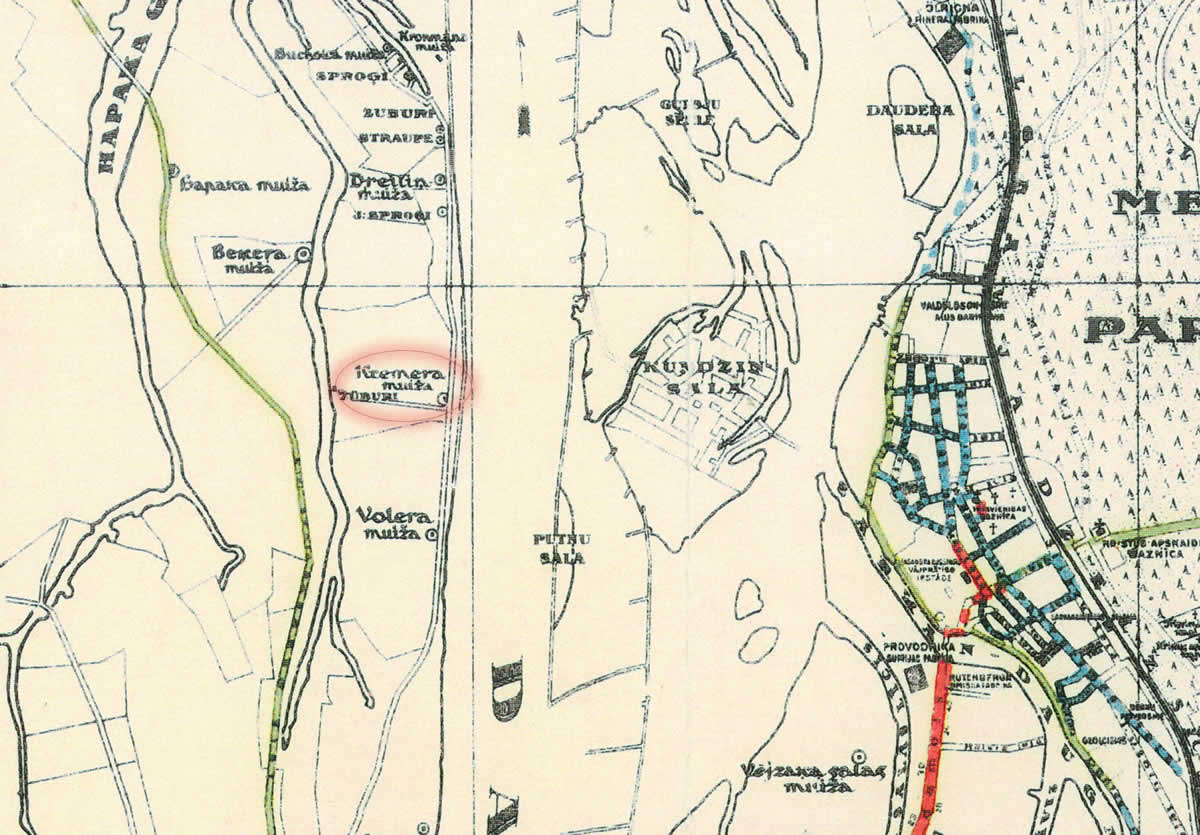
Kremeri manor in the map. 1930
References
- Kaupuža D. Rīgas muižiņas. Latvijas architektūra, Rīga, 2005, p.95.
- Latvijas armijas ģenerālštāba kartes, 1930.
- Broce J.K. Zīmējumi un apraksti, 2.sējums. Rīga, Zinātne, 1996, pp.144.,467.
- Rīgas plāns, 1:50 000, Rīgas pilsētas ielu bruģi un šosejas, 1930.