
| Coordinates: | 56°58'43,31'' N
24°09'01,59'' E
Google Maps (localisation not exact, possible mistake up to 600 metres) |
| No: | 64 (list of all monuments) |
| Category: | Palaces and manor houses |
| Address: | Riga, Ciekurkalns, in the area of Starta, Abulas, Teraudlietuves streets |
| Versions of name: | Gaunersdorfs Hof, Gunersdorf, Gerdt Groons Hof |
| Year of construction: | 17th c.? |
| Condition: | Does not exist |
| Value: | Architecture |
In the work of J.C.Brotze this manor house from 17th century has been shown in map which in turn has been redrawn from earlier map drawn in 1700. As these maps are not exact and the area has changed a lot, it is not possible to localise it exactly. It is possible that it corresponds to another manor mentioned here. Not preserved.
Images
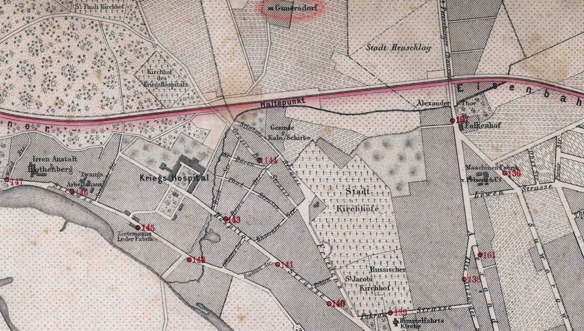
Gaunersdorf manor in Riga mao. 1876.
References
- Broce J.K. Zīmējumi un apraksti, 2.sējums, Rīga, Zinātne, 1996, p.144.
- Plan der Gouvernements Stadt Riga nebst Umgebung, R.Stegman, 1876