
| Coordinates: | 56°57'14,32'' N
24°07'46,05'' E
Google Maps (localisation not exact, possible mistake up to 400 metres) |
| No: | 56 (list of all monuments) |
| Category: | Palaces and manor houses |
| Address: | Riga, Centrs, approximately in the area of Lacplesa, K.Barona, A.Caka, Stabu streets |
| Year of construction: | 17th c.? |
| Condition: | Does not exist |
| Value: | Architecture, archaeology |
This manor from 17th century is shown in the map from 1700 - this map is included in the work of J.C.Brotze. It is not possible to find exact location of the manor from this map as it is schematic, approximate.
Images
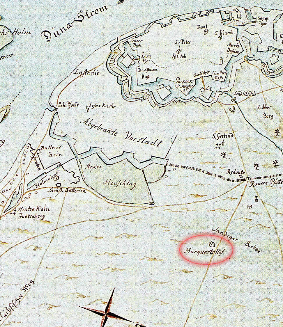
Loaction of Marquart manor. Fragment of the map by J.C.Brotze redrawn from the map of surveyor E.Tolk.
Original drawn cc 1700
References
- Broce J.K. Zīmējumi un apraksti, 2.sējums, Rīga, Zinātne, 1996, p.35.